
“Working with data? Workflow for spatial data management based on models (Use case: Land Administration)”
2019-08-27, 14:00–18:00, Room 4
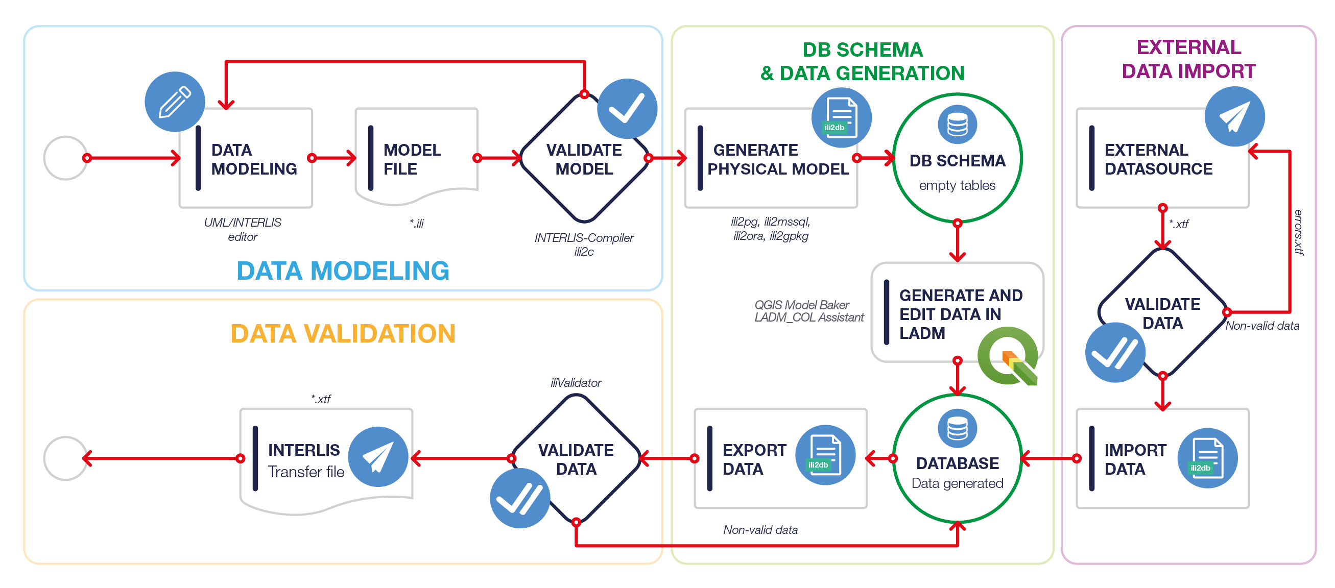
Define your conceptual model (UML Interlis Editor)
Convert a conceptual model to a database (several engines supported[]) (ili2db)
Build automatic forms for data capture from your database (QGIS Model Baker)
Capture data (QGIS/QField [])
Validate captured data (iliValidator)
Exchange your data with other interested parties (ili2db, XTF Interlis Transfer Format)
Import* data exchanged with you (ili2db, XTF Interlis Transfer Format)
Use case: Land Administration Domain Model (ISO:19152)
<img alt="Interlis workflow" src="http://downloads.tuxfamily.org/tuxgis/tmp/interlis_workflow_en.png" />
<hr />
[] GeoPackage, PostgreSQL, Oracle, SQL Server, among others.
[*] QField usage won't fit into the scope, but we will mention it and perhaps show some picture/video.
Free software projects: